
Certified Drone Operations for Maritime & Industrial Environments
EASA Specific & Open Category certified aerial filming and photography coordinated within controlled airspace, active port operations, and restricted industrial sites across Europe's major maritime hubs.
WHAT THIS SERVICE IS
Aerial Documentation Where Permits and Precision Matter
PortSide Media provides certified drone operations for maritime, industrial, and offshore environments throughout the Netherlands, Belgium, and Germany.
We specialize in aerial filming and photography within:
Controlled port airspace (Rotterdam Haven, Port of Amsterdam, Antwerp Port Authority, Hamburg Port)
Active shipyards (Damen, construction zones, drydock operations)
Offshore operations (North Sea, vessel-based filming)
Inland waterways (Rhine, Meuse, Waal corridors)
Industrial facilities (terminals, manufacturing sites, energy infrastructure)
Every flight is coordinated with port authorities, site management, and aviation control — ensuring compliance with EASA regulations, local airspace restrictions, and operational safety protocols.
WHY IT MATTERS
Why Maritime and Industrial Clients Choose Certified Drone Operations
Compliance in controlled zones
Ports like Rotterdam, Amsterdam, and Antwerp operate under strict airspace regulations (CTR zones, restricted areas). We hold EASA Specific certification and coordinate every flight with relevant aviation authorities and port operations centers.
Safety in active environments
Filming around cranes, vessels, cargo operations, and construction sites demands operational awareness. We integrate flight planning with site workflows — respecting exclusion zones, crane radii, and operational schedules.
Visual clarity for complex assets
Large-scale infrastructure — container terminals, shipyards, offshore platforms, inland logistics hubs — requires aerial perspectives to communicate scale, progress, and operational complexity. Ground-level filming can't capture what drone aerials reveal.
Rapid deployment when timing matters
Vessel arrivals, construction milestones, and operational events happen on fixed schedules. We maintain fleet readiness and permit coordination to deploy within 24-48 hours when projects require fast turnaround.
HOW WE DELIVER IT
The PortSide Media Drone Operations Process
Pre-Flight Coordination
EASA flight authorization requests submitted to relevant aviation authorities
Port authority coordination
Site management briefings and access clearances
Airspace assessment (CTR zones, restricted areas, NOTAMs)
Risk assessments and safety protocols aligned with site HSE requirements
On-Site Operations
Real-time coordination with site supervisors and operations teams
Flight operations adapted to weather, operational priorities, and access windows
Backup plans for weather holds, airspace closures, or schedule shifts
Deliverables
High-resolution aerial stills (RAW + processed JPG)
4K/6K video footage (Log profiles for grading flexibility)
Quick-turnaround edits for stakeholder updates or social media
Full project archives for documentation and future use
TYPICAL APPLICATIONS
Where Drone Operations Add Value
Vessel Operations Documentation
Vessel Arrivals
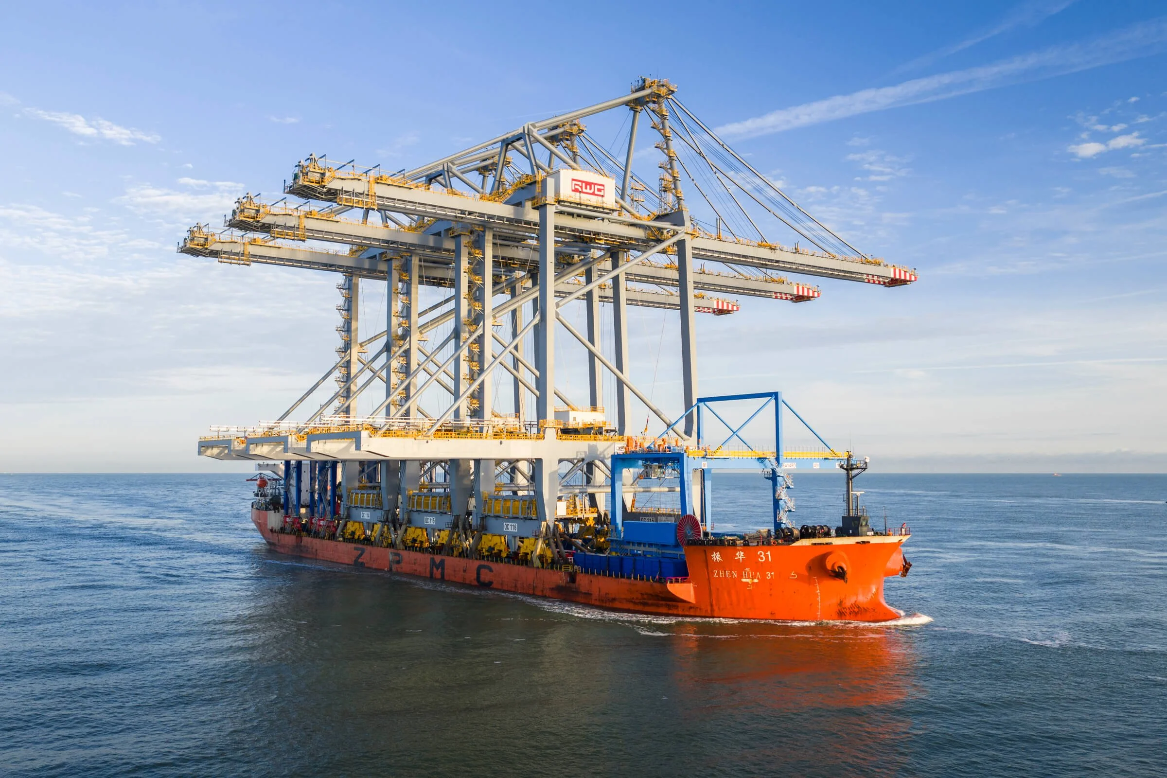
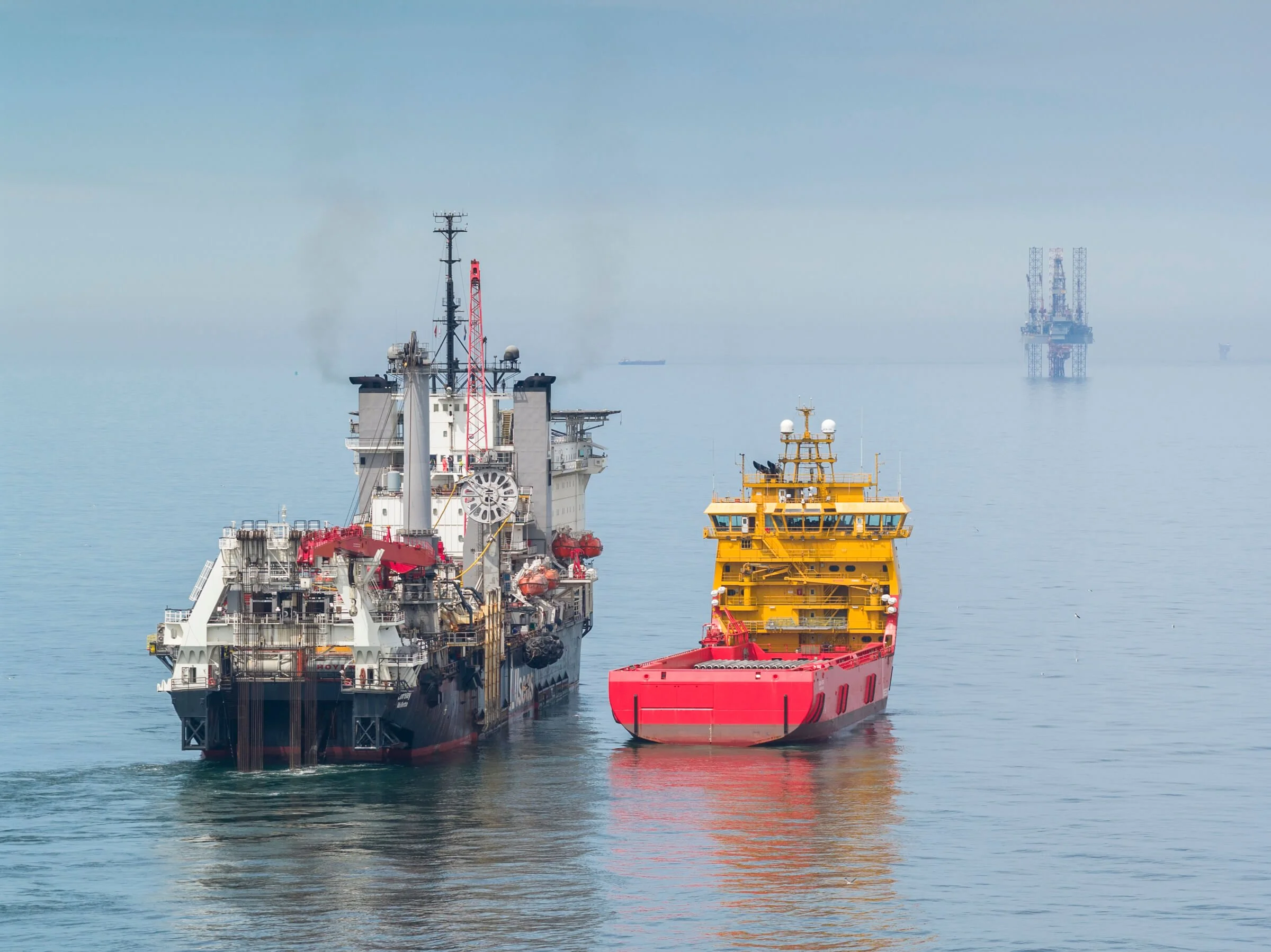
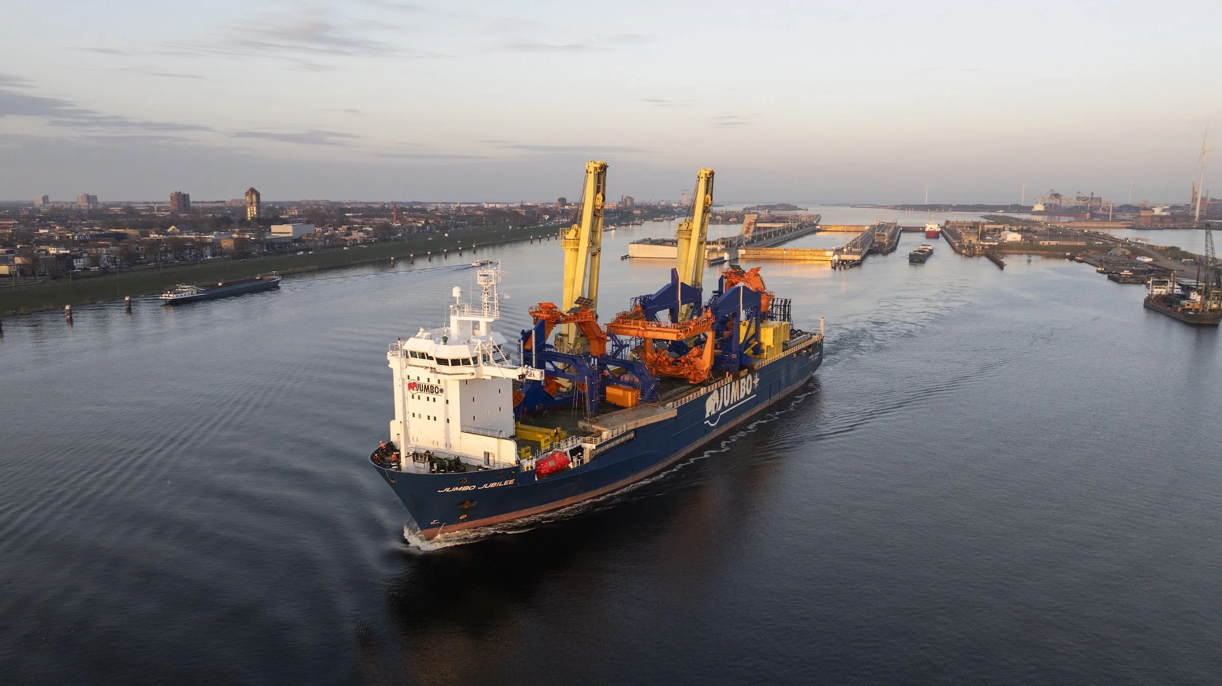
Multi-angle aerial coverage of heavy-lift vessels, container ships, cruise vessels, and specialized cargo ships entering port terminals. Coordinated with port authorities, terminal operators, and vessel agents to document berthing operations, cargo positioning, and ceremonial arrivals. Particularly valuable for maiden voyages, project cargo arrivals, and naval vessel port visits.
Vessel Departures
Departure documentation for newly built vessels, christening ceremonies, sea trial departures, and commissioning events. Aerial coverage of ceremonial send-offs, tugboat coordination, and harbor exits — particularly for shipyard deliveries (Damen Naval, commercial shipbuilding) and special maritime events.
Vessel Inspections
Aerial hull surveys, structural assessments, and pre-purchase documentation. Drone operations provide detailed visual records of vessel condition, hull integrity, deck equipment, and superstructure — particularly useful for large vessels, offshore platforms, and assets in drydock.
Special Loading Operations
Heavy-lift cargo positioning, breakbulk loading, project cargo documentation, and oversized equipment handling. Aerial perspectives capture crane operations, cargo distribution, vessel stability, and terminal coordination for complex loading sequences.
Port & Terminal Operations
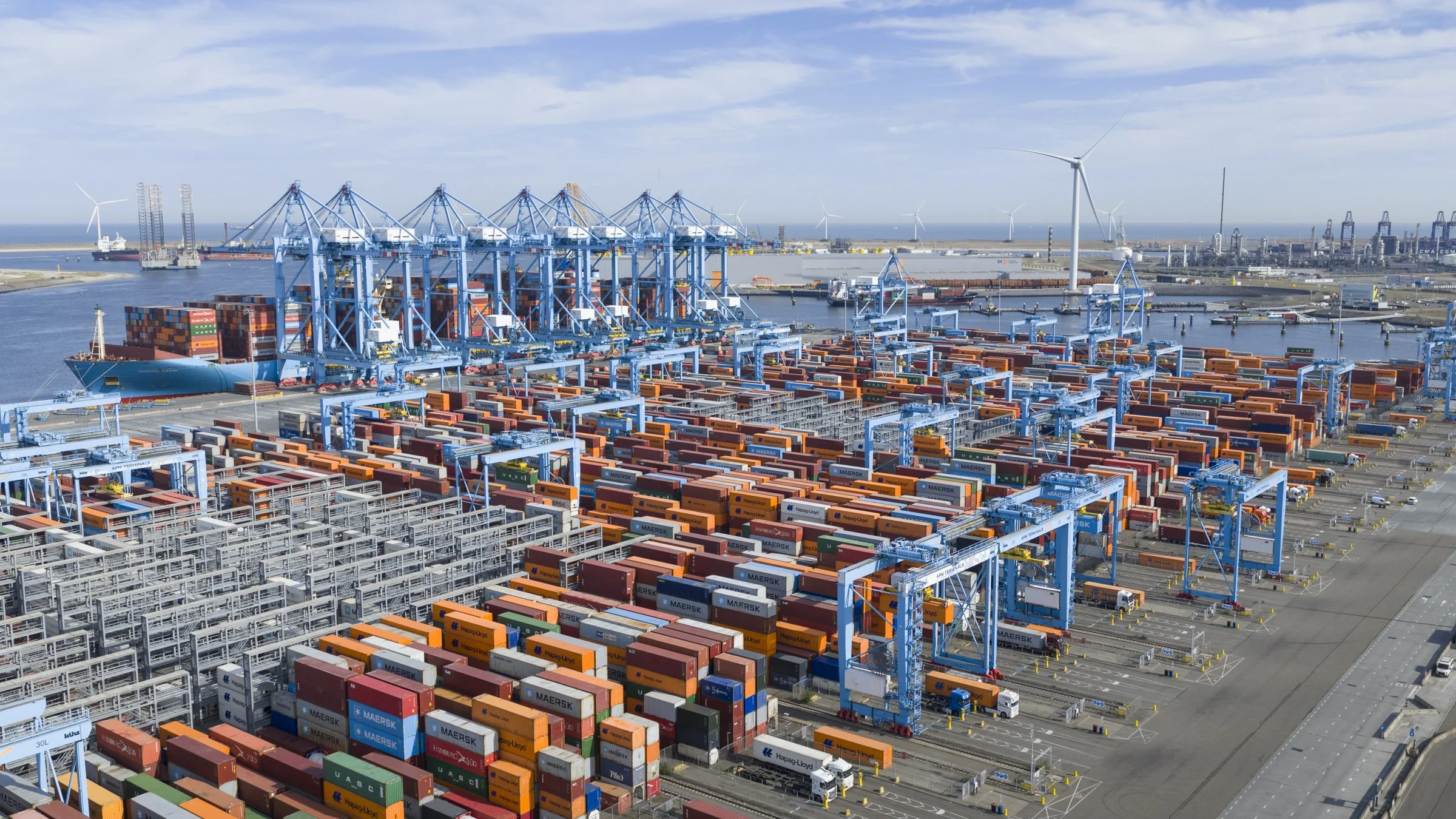
Container Terminal Operations
Operational documentation of high-volume container handling workflows, crane coordination, truck/rail logistics, and vessel loading/unloading sequences. Drone aerials provide visual analysis for operational efficiency studies, training materials, and stakeholder presentations.
Terminal Infrastructure
Aerial surveys of quay walls, container stacking areas, rail infrastructure, and access roads. Documentation for terminal expansion projects, infrastructure assessments, and operational planning.
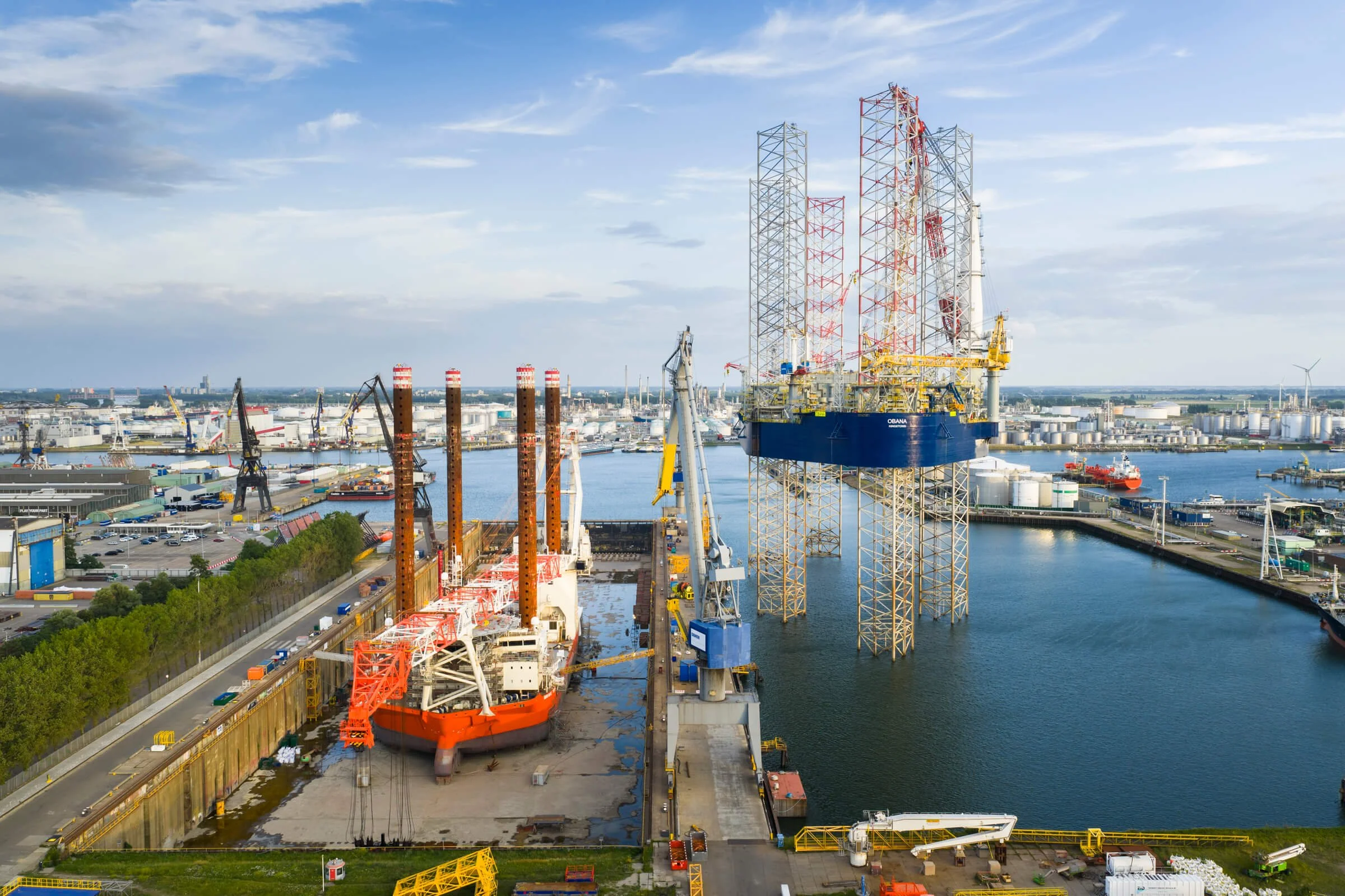
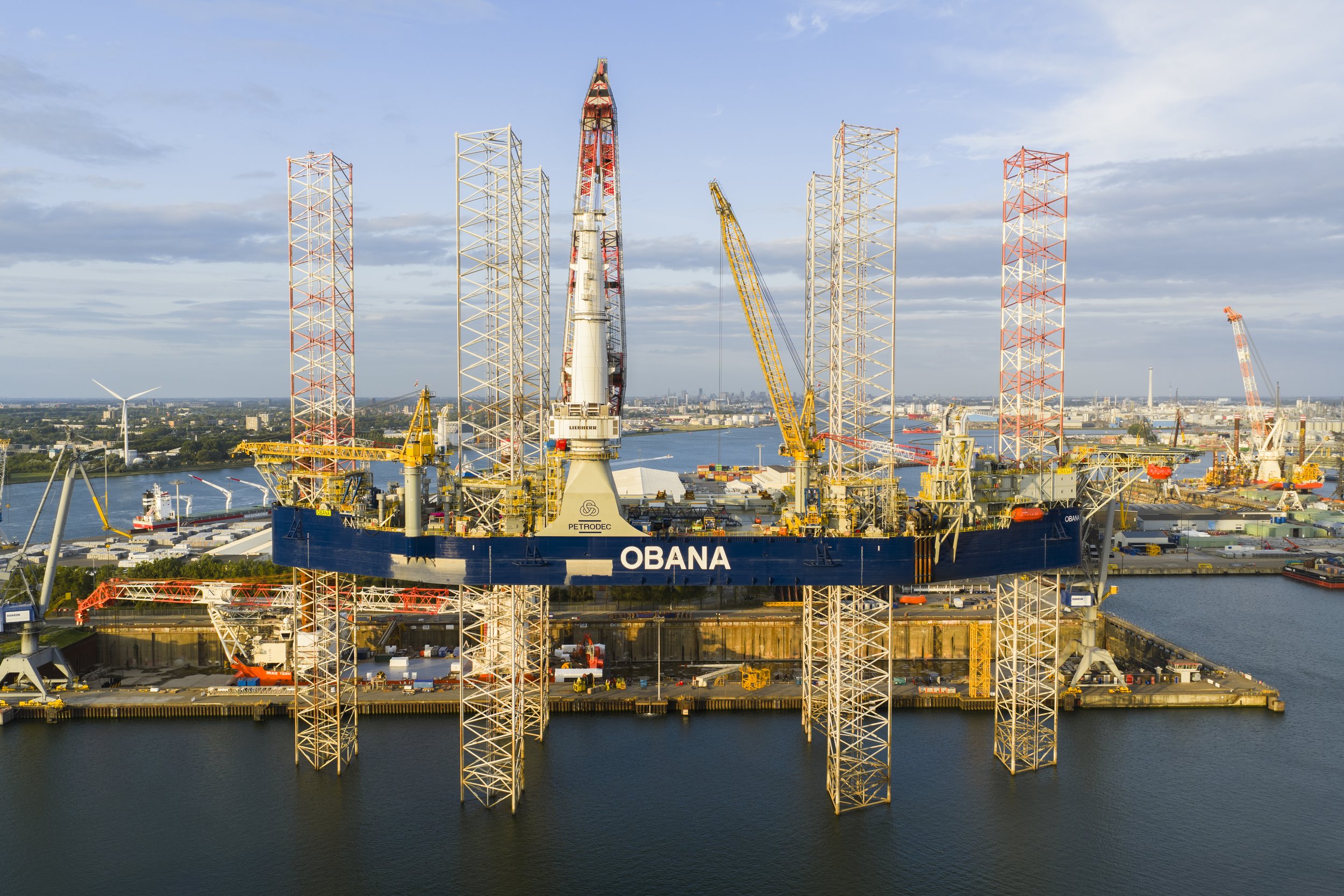
Shipyard & Drydock Operations
Vessel Drydocking
Documentation of cruise ships, commercial vessels, and naval vessels entering and exiting drydock facilities. Aerial coverage captures pre-docking positioning, drydock flooding/dewatering, and vessel movement coordination. Weekly drone surveys track maintenance progress, hull work, and systems access throughout drydock duration.
Vessel Refits
Long-term aerial documentation of structural modifications, systems upgrades, and operational improvements during vessel refit projects. Regular drone surveys (weekly, bi-weekly, monthly) track fabrication progress, contractor coordination, and milestone completion across multi-month refit schedules.
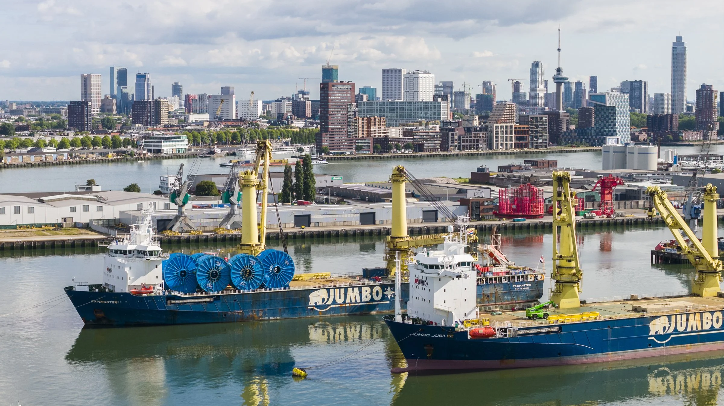
Special Transport
Heavy cargo movements within shipyards and port areas — including module transport, oversized equipment logistics, and specialized lifting operations. Aerial documentation captures transport routing, lifting sequences, and positioning operations for project cargo and construction modules.
Long-Term Construction & Infrastructure
Long-Term Project Documentation
Automated drone surveys (weekly, monthly, quarterly) tracking shipbuilding progress, port infrastructure development, or terminal expansion over extended timelines. Aerial documentation creates visual records of construction milestones, contractor coordination, and project evolution from groundbreaking through commissioning.
TECHNICAL CAPABILITIES
Fleet, Certification & Authorization
EASA Certification
EASA Specific (A1/A2/A3) drone operator certification
Authorization for operations in controlled airspace
Flights coordinated through aviation authorities and port operations
Night time operations exemption
Equipment
DJI Mavic 4 Pro (dual-camera system, rapid deployment, extended flight time)
DJI Mini 5 Pro for Open Category flights and small spaces
FPV systems for dynamic motion filming and confined space operations
Backup units for continuity across multi-day projects
Authorization Range
Port of Rotterdam (Haven operations coordination, Maasvlakte terminals)
Port of Amsterdam (airspace coordination, IJ-corridor operations)
Port of Antwerp (Belgian CAA coordination, Scheldt operations)
Hamburg Port (German airspace coordination, Elbe operations)
Inland waterways (Rhine, Meuse, Waal corridors)
Offshore operations (North Sea, vessel-based filming)
Insurance & Liability
Comprehensive liability insurance covering aerial operations
Project-specific coverage available for high-value assets
Coverage valid across Europe and globally if needed
GEOGRAPHIC COVERAGE
Where We Operate
Regular drone operations across:
Netherlands
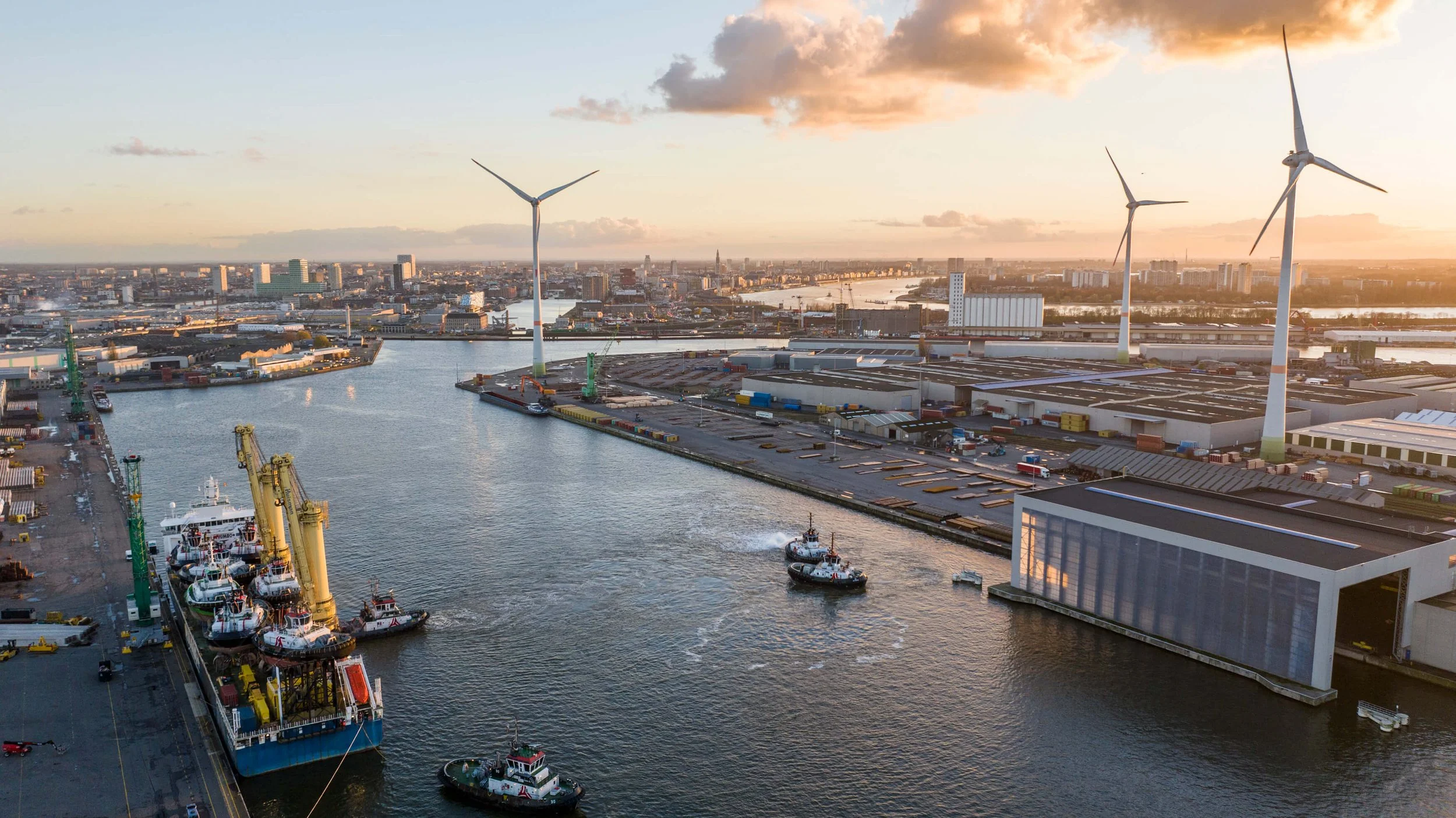
Rotterdam (Haven, Maasvlakte, Botlek, Europoort), Amsterdam (port terminals, IJ-corridor, offshore wind bases), Vlissingen (Damen shipyards, offshore terminals, cruise facilities), Eemshaven (energy terminals, offshore wind operations), Moerdijk (petrochemical terminals, inland shipping), Nijmegen (Rhine corridor operations), Dordrecht (inland port, river operations), Terneuzen (Ghent-Terneuzen canal, chemical terminals)
Belgium
Antwerp (container terminals, shipyards, Scheldt operations), Ghent (canal ports, manufacturing facilities, inland shipping), Zeebrugge (RoRo terminals, offshore wind logistics, cruise operations), Liège (Albert Canal logistics, inland port operations)
Germany
Hamburg (container terminals, shipyards, Elbe operations), Bremen/Bremerhaven (automotive terminals, offshore wind industry, container operations), Wilhelmshaven (deepwater terminals, energy infrastructure), Duisburg (inland port, Rhine logistics hub), Cologne (Rhine corridor operations), Mannheim (Rhine-Neckar operations)
Offshore
North Sea operations (Dutch, Belgian, German EEZ zones, vessel-based filming, offshore wind installations, pipelaying operations)
FAQs
What certifications does Portside Media hold for drone operations?
1
Portside Media holds EASA Specific Category certification (Operational Authorization NLD-OAT-176/01G), enabling operations in controlled airspace around major European ports including Rotterdam CTR, Amsterdam CTR (Schiphol proximity), and North Sea Port restricted zones. We are also certified for night operations and offshore environments, meeting strict European aviation safety regulations. This advanced certification is required for commercial drone operations in port environments and is held by less than 5% of drone operators in the Netherlands.
Can drones operate in Port of Rotterdam controlled airspace?
2
Do you operate drones offshore or on vessels?
What is EASA Specific Category certification and why does it matter?
Yes, but only with EASA Specific Category certification and advance coordination with port authorities and air traffic control. A large part of the Port of Rotterdam operates within Rotterdam CTR (Controlled Traffic Region), requiring specialized authorization and flight clearances. Portside Media maintains ongoing authorization for Rotterdam port operations and coordinates directly with port authority and aviation authorities for each project. General drone operators with only Open Category certification cannot legally film in Rotterdam's controlled airspace.
How far in advance do you need to plan drone operations at ports?
3
Controlled airspace operations typically require 2-3 business days advance notice for flight authorization. This timeline allows for coordination with port authorities, air traffic control, and facility security. For complex projects involving multiple stakeholders (vessel arrivals, offshore operations, shipyard construction), we recommend 1-2 weeks planning time. Emergency or rush projects can sometimes be accommodated with 48-72 hours notice depending on airspace availability and operational constraints.
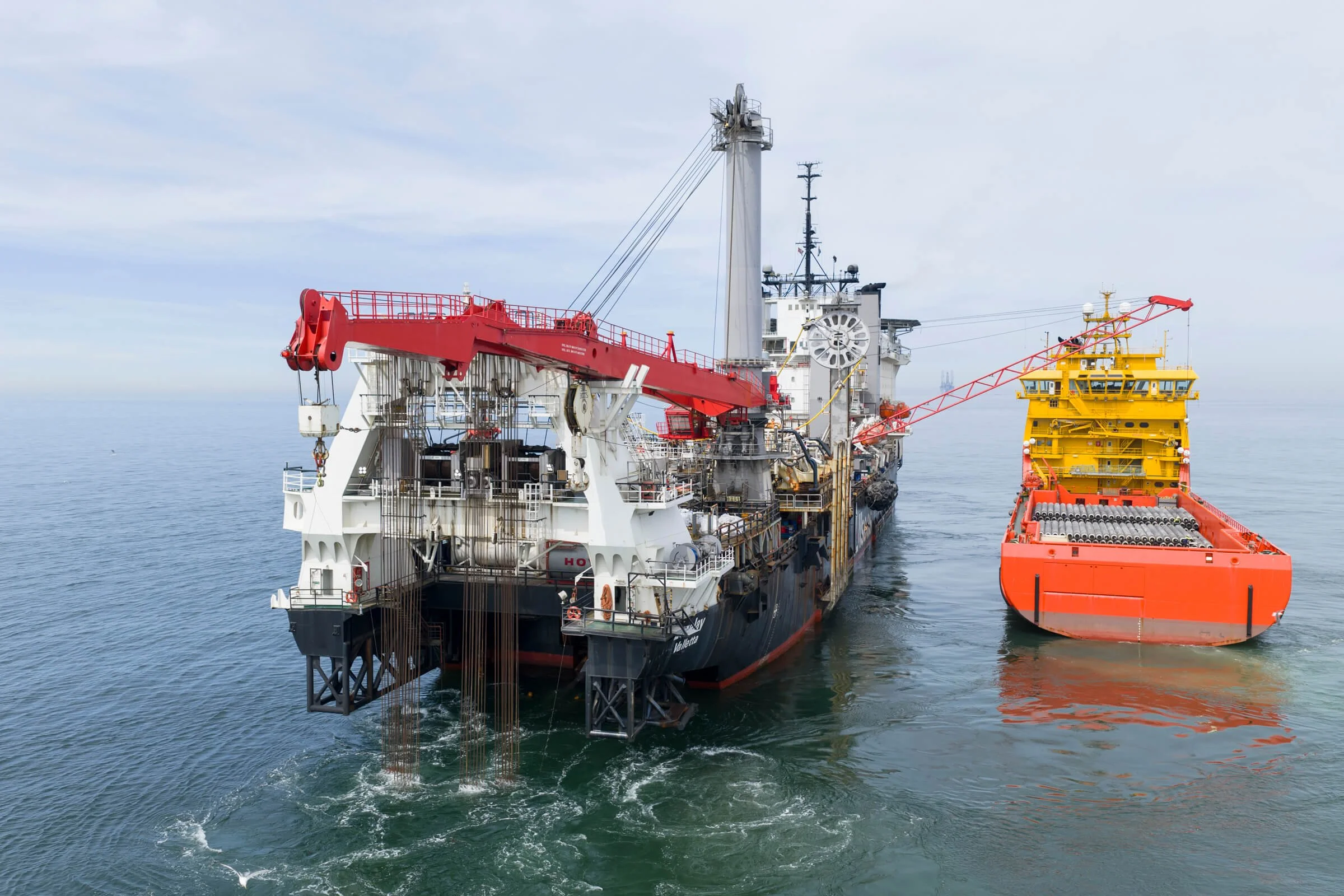
Yes, Portside Media is experienced in offshore drone operations including vessel-based launches, offshore platform documentation, and North Sea filming. Our team includes offshore-certified personnel with BOSIET and HUET safety training. Offshore operations require additional coordination with vessel masters, offshore installation managers, and maritime safety authorities. We've completed offshore projects for Porthos CO₂ pipeline documentation (Allseas Lorelay), Fugro survey vessel operations, and offshore wind construction activities.
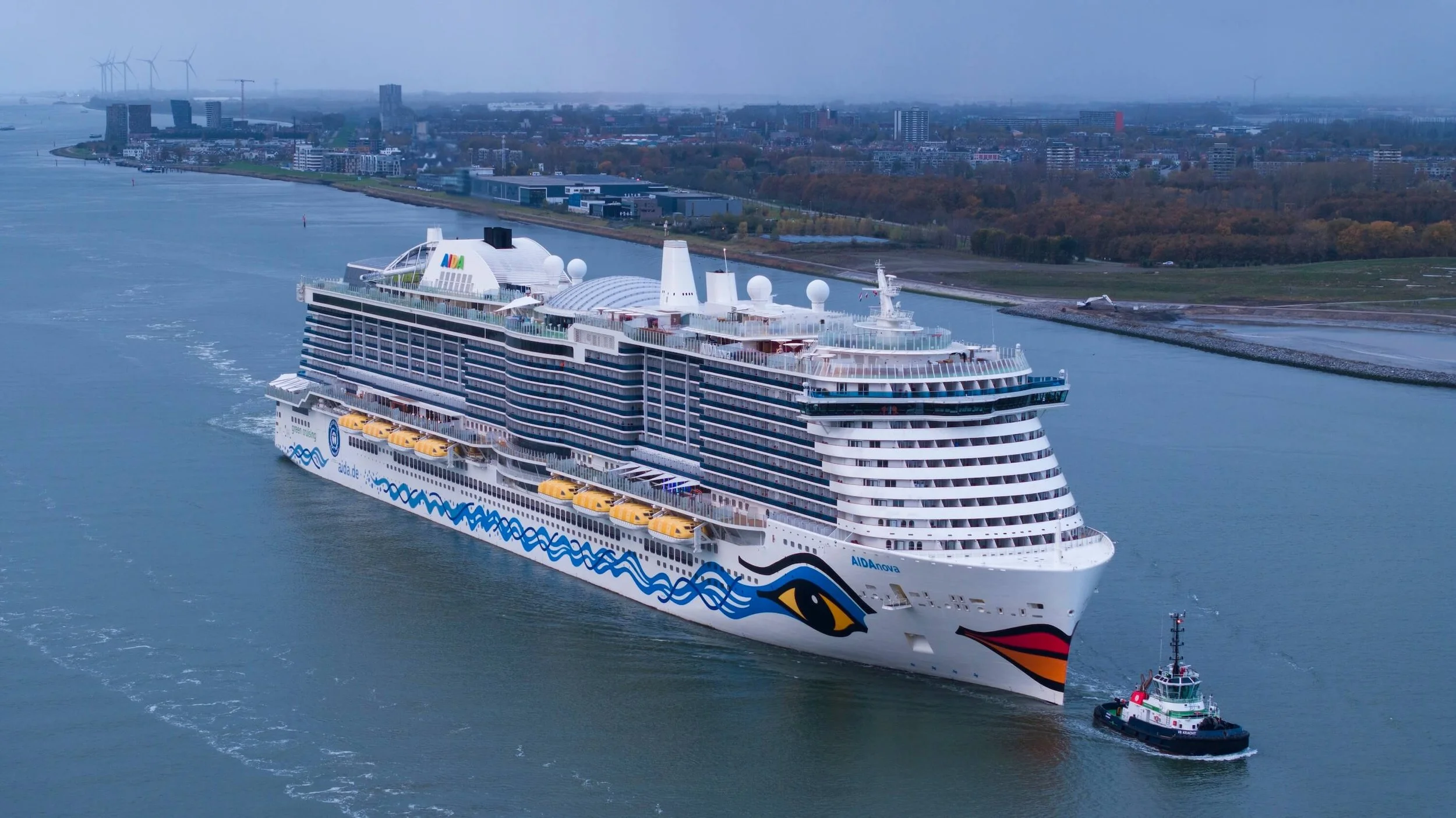
Yes, Portside Media holds night operations certification, allowing after-dark drone filming for vessel arrivals, heavy-lift operations, and time-critical projects outside daylight hours. Night operations require additional authorization beyond standard daylight permissions and specialized low-light camera equipment. Have a look at our Projects page to see a selection of documented night operations for Mammoet heavy-lift at Schiedam, AIDAnova cruise ship arrival at Damen Verolme, and various port terminal operations requiring 24-hour documentation.
EASA Specific Category is an advanced European drone certification for operations that exceed standard Open Category limitations—including controlled airspace, operations over people, night flying, and beyond visual line of sight. It requires operational risk assessment, safety case documentation, and approval from national aviation authorities. For maritime clients, Specific Category certification means we can legally operate in port environments, coordinate with air traffic control, and maintain proper insurance coverage. Most drone operators in Netherlands hold only Open Category (recreational) certification and cannot operate in commercial port environments.
Portside Media coordinates drone operations through advance communication with port authorities, terminal operators, vessel traffic services, and facility managers. We integrate into active operations by understanding vessel schedules, crane movements, cargo handling timelines, and safety exclusion zones. Our operational fluency in maritime environments—recognising vessel types, understanding port terminology, and respecting safety protocols—allows us to work seamlessly inside active sites without disrupting client operations. All flights are logged and coordinated through proper channels with real-time communication maintained throughout operations.
What weather conditions affect maritime drone filming?
4
Can you film at night or in low-light conditions?
5
6
7
8
Maritime drone operations are limited by wind speed (maximum 12-15 m/s for safe operations), visibility (minimum 5km for controlled airspace), precipitation (rain affects camera equipment and flight stability), and temperature extremes (below -10°C or above 40°C impacts battery performance). For offshore operations, we also monitor sea state, vessel movement, and North Sea weather patterns. Portside Media maintains backup scheduling flexibility to accommodate weather delays without compromising project timelines.
How do you coordinate drone operations with active port activities?
RELATED PROJECTS
Ready to Plan Your Next Aerial Operation?
Whether it's a single-day vessel arrival, multi-month construction documentation, or offshore deployment — we coordinate drone operations within your operational constraints and airspace requirements.